

Fort Osborne Barracks:
Originally established as a wooden fort on what is now the west lawn of the Provincial Legislature in Winnipeg in 1873, the barracks was later named after Colonel William Osborne Smith, the first commander of the Military District No. 10 in Winnipeg.
In 1917, the former campus of Manitoba Agricultural College was converted into a military convalescent hospital and two years later, the entire campus was taken over by the military and Fort Osborne Barracks re-located to this site, becoming the primary army base in Manitoba.
The Princess Patricia’s Canadian Light Infantry and 2 Royal Canadian Horse Artillery were stationed at the barracks.
A second site was established just to the south on a 90-hectare parcel of land at the intersection of Kenaston Boulevard and Grant Avenue during World War II. This new site became known as Fort Osborne Barracks South.
As a result of the Unification, Fort Osborne Barracks closed in 1968 and all operations were moved to Fort Osborne Barracks South, which merged with RCAF Station Winnipeg to form CFB Winnipeg.
The property was returned to the provincial government, who utilized several of the buildings for office space. The main building became a juvenile court facility.
The campus became a provincially-designated historic site in 1995. The property was sold in 1997 and redeveloped as the Asper Jewish Community Campus of Winnipeg.
Roblin Hall was demolished in the early 1980s.
Sources: http://www.mhs.mb.ca/docs/sites/agriculturalcollege.shtml, http://www.fortwiki.com/Fort_Osborne_Barracks.
-

- The first Fort Osborne Barracks was established in 1873. The barracks was located along the north end of Osborne Street. Historical drawing.

-

- Assiniboine Park, old Fort Osborne Barracks, and the future Kenaston Blvd circa 1923. Historical photo.

-

- Fort Osborne barracks, Roblin Hall district H.Q. from roof of instructional bldg. Historical photo.

-

- Fort Osborne Barracks looking SE from Broadway. Historical photo.

-

- Fort Osborne Barracks Main Building. Historical photo.

-

- Fort Osborne Barracks Main Building. Historical photo.

-

- Winnipeg Grenadiers at Fort Osborne Barracks before departure to Hong Kong. Historical photo.

-

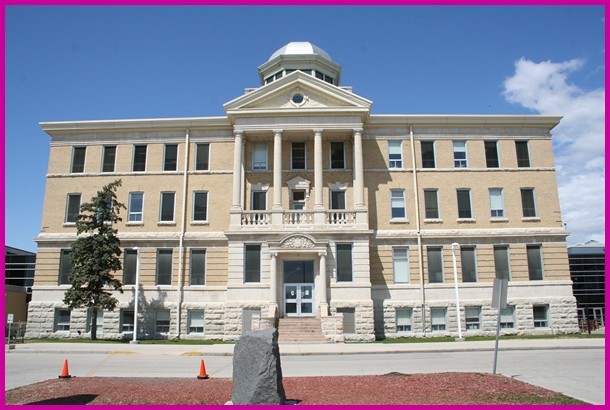
- Fort Osborne Barracks Main Building, July 2016. Photo: John Stanton.

-

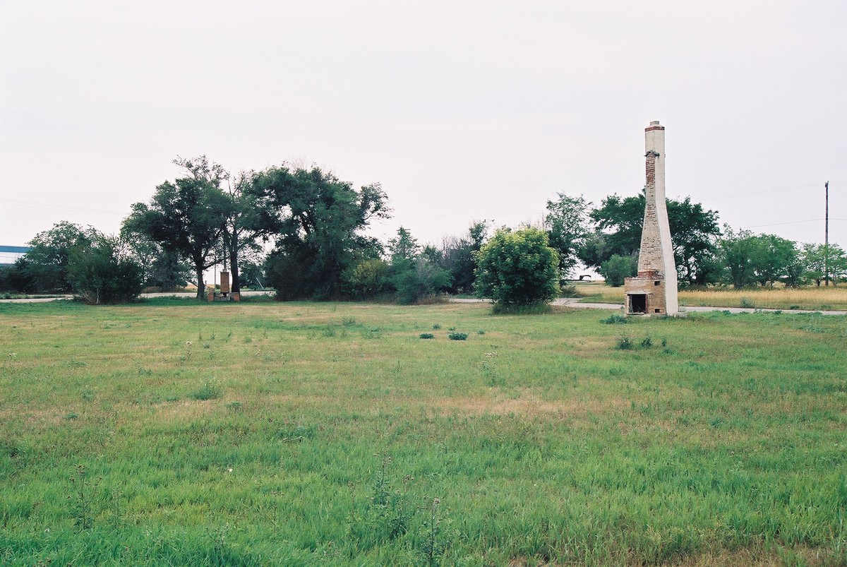
- Fort Osborne Barracks Marker, July 2016. Photo: John Stanton.

-

- Fort Osborne Barracks Monument. Photo: Unknown.

-

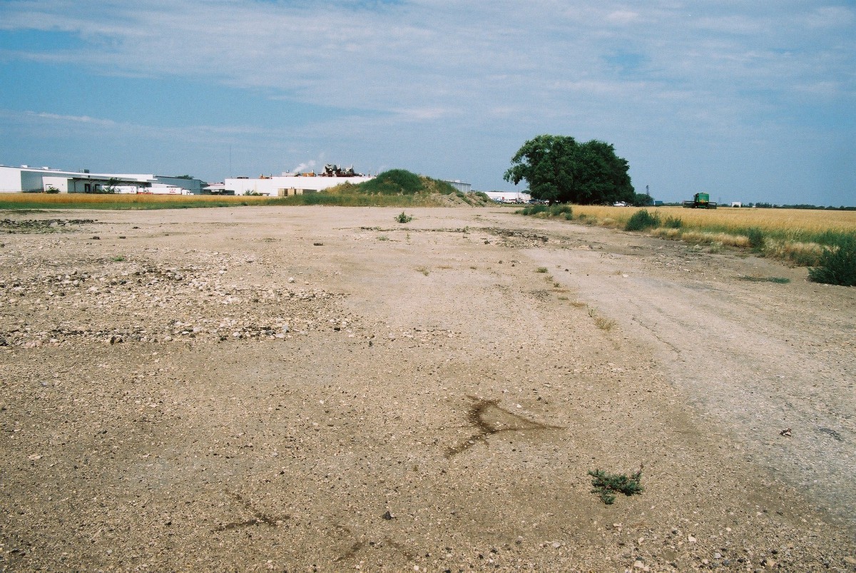
- Fort Osborne old site, November 1991. Photo: Unknown.

-

- Manitoba Agricultural College (Fort Osborne Barracks) Administration Building. Photo: Unknown.
-

- Manitoba Agricultural College (Fort Osborne Barracks) Main Gates (Tuxedo Avenue). Photo: Unknown.

-

- Manitoba Agricultural College (Fort Osborne Barracks) Powerhouse. Photo: Unknown.

-

- Fort Osborne Barracks, July 2022. Photo: Google Maps..

-

- Fort Osborne Barracks, July 2022. Photo: Google Maps..

Opened during World War II as Fort Osborne Barracks South, just south of the of the original Fort Osborne Barracks, this was the home of The Lord Strathcona’s Horse, the 2nd Battalion, Princess Patricia’s Canadian Light Infantry (2 PPCLI) and 2 Royal Canadian Horse Artillery.
The barracks was originally situated on a 90-hectare parcel of land at the intersection of Kenaston Boulevard and Grant Avenue, consisting of over 50 buildings and warehouses.
After World War II, the newly formed Prairie Command Headquarters took up residence on site and by 1957, Fort Osborne’s role was to provide support services for Army units under control of Prairie Command.
Around 1950, approximately 350 permanent married quarters (PMQs) were constructed for families posted to the base, some along Keanaston Boulevard and some between Fort Osborne (North), from Tuxedo Avenue and Grant Avenue.
In 1967, some of Fort Osborne’s barracks were utilized by the Pan American Games for housing athletes.
As a result of the Unification in 1968, the original Fort Osborne Barracks closed and Fort Osborne Barracks South merged with RCAF Station Winnipeg to form CFB Winnipeg. The barracks were officially designated as CFB Winnipeg (South), although the name Fort Osborne Barracks remained in use.
On 17 May 1973, Fort Osborne Barracks was re-named Kapyong Barracks, after the battle of Kapyong, fought by 2 PPCLI in Korea in 1951.
The 3rd Battalion, Royal Canadian Regiment was posted to Kapyong from 1984 – 1988 while 2 PPCLI was posted to Germany. The regiment returned to Kapyong after this tour.
As a result of massive cutbacks to the Department of National Defence, CFB Winnipeg’s Kapyong Barracks began downsizing in the mid 1990s, leaving the base with only 65 hectares. Some of the PMQs were sold to civilians at that time.
The downsizing was only the beginning of the end for Kapyong Barracks, however. The withdrawal of the German Army and the closure of the German Army Training Establishment at nearby CFB Shilo in 2000 lead to the need to consolidate Defence assets in Manitoba. The Department of National Defence decided that it no longer needed to maintain two Army bases in such close proximity.
As Kapyong Barracks had aging infrastructure, was small in size and was now completely surrounded by development compared to CFB Shilo’s newer facilities, remote location and larger size, it became obvious which base should close.
Kapyong Barracks closed in June 2004 and 2 PPCLI re-located to new facilities at CFB Shilo. A formal march-out ceremony and parade was held at the end of June 2004 to commemorate the men and women who served at Kapyong Barracks.
Not long after the closure, the abandoned Kapyong Barracks found a new use as an urban “close quarter combat” training area for Winnipeg area militia troops.
Of the 350-plus PMQs, about two-thirds are still rented to soldiers and their families. Local politicians have been trying to convince Ottawa to rent out some of the vacant homes at Kapyong to low-income families or recent immigrants. However, the process of disposal at Kapyong has been paralyzed by red tape and a First Nations land claim.
The former base was to have been turned over to the Canada Lands Corporation for disposal, but in 2007, the Treaty 1 bands asked federal court to block the transfer of Kapyong to the Canada Lands Company, which was to organize its sale.
By 2012, the fate of Kapyong was still in legal limbo, with the courts having ruled in favour of the First Nations complainants. There are obvious signs of deterioration on the 90-hectare site, including mold and peeling lead paint inside some the vacant buildings, water in the basement of at least one building and hundreds of squirrel holes outside.
As of January 2013, taxpayers had spent nearly $15 million over the last eight years maintaining the vacant Kapyong Barracks site while the federal government fights a land claim for the site by Treaty One First Nations.
In January 2014, the federal government filed an appeal in court to prevent a handful of First Nations groups from taking over all or part of the vacant Kapyong Barracks land.
In 2015, Prime Minister Stephen Harper announced that his administration would no longer pursue an appeal relating to the Kapyong lands.
By November 2016, the federal government announced plans to demolish the vacant Kapyong buildings, along with the roadways, parking lots, and hydro, gas and water infrastructure, citing the $15-$20 million in costs to maintain the property since 2004. Lyse Langevin, director general of infrastructure and environment for the Department of National Defence, advised that the buildings had deteriorated to such a degree that demolition was the only practical solution, something it had been prevented from doing while there was ongoing litigation. DND had no intention of using the buildings again.
Demolition of the buildings began in 2017, along with around 20 PMQs to accommodate the widening of Kenaston Blvd. Around 300 other PMQs remain occupied by military families, with some undergoing renovations.
In May 2017, Dennis Meeches, Chief of the Long Plain First Nation, announced some of the plans for the land once its returned to the Treaty One nations, plans which include a condo complex, single dwelling homes, office space, big box stores, a mall, a casino and a war museum to honour Kapyong’s military history.
In the spring of 2020, the Department of National Defence began demolition of all buildings and infrastructure. Nothing remains of Kapyong Barracks today.
Source material: “The Maple Leaf” Vol 4, Nov 15 2001, DND press release from May 1989, “Sentinel” Magazine from June 1973, pg. 27, Legion Magazine January – February 2005, “The Maple Leaf” Vol 4, April 26, 2006, the Winnipeg Sun: http://www.winnipegsun.com/news/manitoba/2010/06/21/14470161.html, Te Winnipeg Free Press from 2 April 2009, CBC web site – http://www.cbc.ca/news/canada/manitoba/story/2012/09/17/mb-kapyong-barracks-tour.html, Winnipeg Free Press, 10 January 2013 – http://www.winnipegfreepress.com/local/Millions-spent-maintaining-empty-Kapyong-Barracks-during-land-claim-dispute-186402951.html, Battle over Kapyong Barracks back in court, Toronto Sun, 13 January 2014, CBC website – http://www.cbc.ca/news/canada/manitoba/kapyong-barracks-feds-government-tear-down-1.3854930, http://globalnews.ca/news/3472609/development-of-winnipegs-kapyong-barracks-inching-ahead, https://www.winnipegfreepress.com/local/kapyong-coloured-memories-441753453.html, http://www.fortwiki.com/Fort_Osborne_Barracks, https://winnipeg.ctvnews.ca/how-you-can-weigh-in-on-the-future-of-the-kapyong-barracks-redevelopment-1.494540 & the personal recollections of the author (2003).
-

- Aerial photos of Kapyong Barracks, July 2016. Photo Boris Minkevich, Winnipeg Free Press.

-

- Barracks, August 2003. Photo: Bruce Forsyth.

-

- Main gate, August 2003. Photo: Bruce Forsyth.

-

- Drill Hall and barracks, August 2003. Photo: Bruce Forsyth.

-

- Kapyong memorial in front of the Officers’ Mess, August 2003. Photo: Bruce Forsyth.

-

- Barracks, August 2003. Photo: Bruce Forsyth.

-

- Chapel, August 2003. Photo: Bruce Forsyth.

-

- Recreation Centre, August 2003. Photo: Bruce Forsyth.

-

- PMQs, August 2003. Photo: Bruce Forsyth.

-

- Patricia Pats Inspection Kapyong, date unknown. Photo: Unknown.

-

- Fort Osborne/Kapyong Barracks, 1966. Photo Sentinel magazine.

-

- Kapyong Barracks demolition underway, 19 May 2020. Photo: Jamie Dowsett/CTV News Winnipeg.

-

- Kapyong Barracks, May 2023. Photo: Google Maps.

-

- Kapyong Barracks, May 2023. Photo: Google Maps.

-

- Kapyong Barracks, May 2023. Photo: Google Maps.

Canadian Forces Base Rivers:
Long-time residents of the Rivers area will probably remember a time when the air buzzed with the sound of RCAF aircraft from an airfield south-west of Rivers. Early in the Second World War, the Royal Canadian Air Force entered into an ambitious project: the British Commonwealth Air Training Plan, an astounding program that saw 130,000 personnel from Great Britain and the Commonwealth graduate from 107 training schools across Canada. One such station would be RCAF Station Rivers, situated 250 kilometres west of Winnipeg.
Originally opened in November 1940 as the new home of No. 1 Air Navigation School (No. 1 ANS), originally formed at RCAF Station Trenton. One reason for locating the school near Rivers was due to the generally cloudless skies, making it ideal for astronavigation training.
The school had all the amenities of an RCAF training school including hangars, a drill hall, administration buildings, a medical inspection room, mess halls, classrooms and H-hut barracks, although unlike most RCAF stations, some were 2 story H-huts. The airfield consisted of 3 runways in a triangle pattern.
By February of 1941, the staff complement consisted of 56 officers and 424 airmen. The following month, the first of the Commonwealth trainees arrived in Rivers from Australia and New Zealand.
In May 1942, No. 2 ANS re-located to Rivers from Pennfield Ridge, New Brunswick and merged with No. 1 ANS to become No. 1 Central Navigation School (No. 1 CNS).
As the war progressed, Rivers also became a training centre for Army pilots and parachutists, as well as flying instructors from the Army, RCN and RCAF. Additionally, the Air Support Signal Unit, Royal Canadian Corps of Signals and the Air Dispatch School were stationed at Rivers.
By the time No. 1 CNS disbanded in August 1945, the combined total of navigators trained by both No. 1 ANS and No. 1 CNS had reached 11, 406 navigators.
RCAF Station Rivers would remain open after the war, becoming part of the post-war RCAF. Over the preceding years, several new buildings would spring up at Rivers, including a central heating plant, a new arch hangar, Permanent Married Quarters and a school for dependent children.
Several new units began operations at Rivers in 1947, including the Parachute School. The Canadian Parachute Training Centre, originally established at Camp Shilo in 1942, re-located to RCAF Station Rivers and merged with the Joint Air School, which had been founded at Rivers in 1947, becoming the Airborne School and making Rivers Canada’s main para-training centre. The school was renamed the Canadian Joint Air Training Centre in April 1949.
Also in 1947, the Army Aviation Tactical Training School was established at Rivers to provide pilot training to Army fixed-wing aviators, as well as helicopter instructor training for the Army, RCN and RCAF. No. 6 Signal Regiment, Royal Canadian Corps of Signal and the Air Support Signal Unit (later down scaled to a Troop) provided communications duties at Rivers. 444 Air Observation Post Squadron was formed on 1 October 1947, but had a brief stay at the station as it disbanded 1 April 1949.
In 1948, the Joint Air Photo Interpretation School opened at RCAF Station Rivers. The school closed in 1960 and its personnel merged with the Air Photo Interpretation Centre at RCAF Station Rockcliffe, who became fully responsible for training photo-interpreters.
The Basic Helicopter Training Unit (BHTU) was established at RCAF Station Rivers in August 1953, initially to train RCAF pilots, but after the closure of the helicopter school at RCN Air Station HMCS Shearwater, the Royal Canadian Navy began sending trainees to Rivers as well.
In 1956, with the Royal Canadian Navy having recently acquired its first fighter jet, the F2H3 Banshee, pilots from VF 870 and VF 871 Squadrons were also sent to Rivers for training. The RCN training program at Rivers continued until the disbandment of VF 871 Squadron in 1962.
Army helicopter pilots also began training at Rivers when the Army Aviation Tactical Training School (AATTS) was formed in the summer of 1961.
The first helicopter employed by military forces in Canada was the RCAF’s Sikorsky H-5 (S-51) in 1947. RCAF Station Rivers used the H-5 as a rotary wing trainer, but it was also used by the Royal Canadian Air Force in search and rescue roles.
In December 1963, No. 1 Transport Helicopter Platoon (No. 1 THP), a unit of the Royal Canadian Army Service Corps, was established at RCAF Station Rivers, along with their fleet of CH-113A Voyageur transport helicopters and one CH-112 Nomad. The platoon’s function was to support the Army on field exercises. No. 1 THP moved to RCAF Station St. Hubert in 1966, but also established a detachment at RCAF Station Namao. In 1968, No. 1 THP was re-designated 450 (Heavy Transport) Helicopter Squadron.
408 Tactical Fighter Squadron, whose primary functions were reconnaissance and weapons delivery, moved to Rivers in 1964 from RCAF Station Rockcliffe, and remained until disbanded on 1 April 1970.
Rivers was also the home of the Airborne Section, Trials and Evaluation Establishment from 1965 to 1970.
As a result of the Unification, RCAF Station Rivers was re-named CFB Rivers.
The main ramps and runways 08-26 and 13-31 were resurfaced during 1969 and 1970. However, with the recent introduction of the Canadair CF-5 Freedom Fighter into service, the runways at Rivers proved to be too short to handle the new jet. precipitating the eventual demise of the base itself.
With the Unification of the Forces in the mid 1960s, a reorganization and consolidation occurred within the Canadian Military. Numerous bases across the country were downsized to detachments of other bases or declared surplus to defence needs and closed. CFB Rivers fell into the latter category and was slated for closure.
All remaining training schools also wound down their operations at Rivers and either disbanded or re-located to other bases across Canada.
No. 4 Fighter Training School (formerly the BHTU and the AATTS) re-located to CFB Portage La Prairie in July 1970 and the Canadian Parachute Training Centre moved to CFB Edmonton, home to the Canadian Airborne Regiment.
CFB Rivers closed in September 1971, ending almost 3 decades of service to the Royal Canadian Air Force.
In September 1972, the land was turned over to the Department of Indian Affairs and Northern Development and the site became the home of the Oo-Za-We-Kwun Centre, a vocational training centre for Manitoba Indians that trained over 10, 000 people.
There were four factories on the property: Edson Industries, a truck camper and trailer manufacturer, Arnold Manufacturing, who produced fiberglass furniture for restaurants, Sekine Cycle, a Japanese bicycle manufacturer and Tim-Br-Fab Industries, a producer of prefabricated homes and the only company still in business today. These industries were required to hire at least 25% First Nations employees.
The Oo-Za-We-Kwun Centre closed in 1980, having trained over 10, 000 students. Sekine Cycle went into receivership in August 1981, officially shutting down the following January.
Although the RCAF had departed, the Rivers Gliding School, a summer Air Cadet glider camp, was established in 1974, continuing the tradition of training young airmen and airwomen at Rivers.
The Air Force would formally make a return to Rivers in 1982 with the establishment of the Canadian Forces Air Reserve National Training School, a summer training centre. Courses conducted included General Military Training 1 & 2, Admin Clerk TQ3, Common Aircraft Servicing, Common Mechanical Training, Common Basic Electrical Training for aircraft trades as well as Base Defence Force/ Aid to the Civil Power Training.
The Air Reserve school was run in the old hospital building, the two story barracks and h-huts adjacent to the hospital and utilizing several ” officers’ row” PMQs.
The school Commandant in 1982 was Captain Al Palmer and the SWO was WO Ron Pruden. In 1983, the Commandant was Major Glen Emerson and the Station Warrant Officer was Master Warrant Officer Ron Pruden. The original intent with the enlarged training program in 1983 was to reopen a large part of the base for the Youth Temporary Employment Program, but this never came to fruition.
After only 2 summers, the Air Reserve National Training School closed in August 1983, followed in 1984 by the Rivers Gliding School, which re-located to CFB Gimli, officially ending a 4 decade-long Air Force presence at Rivers.
The land was put up for sale by the Federal Government. In the interim, the former station was made available for various community uses.
Larry and Bonnie Friesen purchased the land and opened Hangar Farms Ltd. in 1988, a hog-farm operation, later changing the name to Aero Farms. The hangars and some of the barracks were used for livestock and equipment storage. As the years went by, many of the buildings and PMQs were either demolished or left to deteriorate and crumble. Two of the WWII-era hangars were destroyed by fire.
In 2010, Aero Farms owner Larry Friesen died when he about 21 feet to his death while working on a roof of one of the hangars. The hog operation ceased in 2011 and the site sat vacant, with the remaining buildings rapidly crumbling until 2013, when 2 companies bought the property.
Springland Manufacturing, a manufacturer of grain handling equipment and commercial storage bins, took over the buildings and the runways. The rest of the land is farmland.
Only small parts of the old air station remain today including old supply buildings, one of the World War-era hangars, the recreation centre, the pool, the gunnery backstop, power plant, fire hall, 3 of the two-story H-huts, ruins of the messes, five permanent married quarters (PMQs) and assorted utility buildings.
The old firehall has been restored and now serves as the company and engineering offices for Springland Manufacturing. The recreation centre was also restored and used for fertilizer storage, as is hangar #5, one of 2 remaining WWII-era hangars 450 Helicopter Squadron. Hangar #6, the “Arch” hangar, formerly occupied by 408 Tactical Fighter Squadron, was also cleaned up and restored for future use.
The WWII hangar with the control tower was destroyed by a fire in 2014.
The entire airfield remains although a reservoir sits across one of the runways. Although the runways were listed as abandoned many years ago, they continued to see occasional use by airplanes for aerial spraying and firefighting flights operated by Springland. The airfield had previously been used by Pacific Western Airlines in 1982 while the runways at the Brandon Airport were being resurfaced.
Baseline Dragway also uses one of the old runways as a dragstrip.
Springland Manufacturing will be expanding their operations at the Rivers site over the next few years and are re-locating many assets from their other site at the Lepp family farm north of Rivers, where the company was founded in 1985.
In the early 1990s, the RCAF returned to Rivers with the help of some movie magic in the film “For The Moment”, a film about an Australian pilot who comes to Manitoba to train under the BCATP, starring Russell Crowe. While most of the movie was filmed at the Brandon Airport, scenes of the actors standing outside their barracks were filmed at Rivers, requiring a fresh coat of green paint to be applied to the old buildings.
Also of note in the history of Rivers is the story of the “Rivers Bell”. The “Rivers Bell” was a gift from the Royal Canadian Navy to the Canadian Joint Air Training Centre at RCAF Station Rivers in November 1951 and bell hung in the Officers’ Mess. The bell was stolen in 1955 by visiting personnel from RCAF Station Moose Jaw, who transported it back to their mess back in Moose Jaw.
The Base Commander at Rivers, Group Captain Jack Sproule, was none too happy about this turn of events. To rectify the situation G/C Sproule led a “rescue party”, to retrieve their bell when visiting Moose Jaw one weekend in September 1955. The orderly officer and mess staff were tied up and a hack saw was used to cut the bell loose from the steel beam to which the bell had been attached. It was then spirited out of the mess to the nearest perimeter fence, where it was tossed to accomplices sitting in a waiting getaway car.
When re-installed in the Officers’ Mess at Rivers, the bell secured so well, that when RCAF Station Rivers closed in 1971, LCOL Bill Svab, who designed the “security measures”, had to be consulted on its removal. The “Rivers Bell” was then re-located to the Officers’ Mess at RCAF Station Portage La Prairie, where it remains today.
Another link to River’s RCAF past is the Captain Kenneth Young Memorial Award, an annual award that recognizes the most proficient rural Royal Canadian Air Cadet squadron in Manitoba. The award is named after Captain Kenneth Young, a RCAF pilot who was killed in a helicopter crash at CFB Rivers (now closed) on 10 June 1970. A former air cadet himself, Captain Young was the Senior Air Cadet Liaison Officer at CFB Rivers at the time of his death.
Source Material: Sentinel Magazine March 1966, pg 1, March 1967, pg 1, April 1967, pg 14, April 1968, January 1967, April 1970, pg **, 1972 & April 1973, pg 28, the British Commonwealth Air Training Plan Museum site – www.airmuseum.ca, the personal recollections of Colonel J.C. Forsyth, OBStJ, CD, Honorary Colonel, Royal Hamilton Light Infantry – 1993-2007 (1999) & Electronics Museum site – www.c-and-e-museum.org, the Air Cadets Glider Training web site – http://www.mts.net/~rgspra/hist.html, information supplied by Michael Turnbull, Chief Constable, Rivers Police (1999), 450 Squadron web page – www.totavia.com/terry/cyow/uplands/450sqn.htm, The Town of Rivers web sites – http://www.techplus.com/rivers, http://www.townofrivers.mb.ca/history.htm#history, History of the 400 Series Squadrons – http://www.airforce.dnd.ca/airforce/eng/history_400s/rcafsqns.htm & Canada’s Air Force At War & Peace Vol 3- by Larry Mulberry, information supplied by Larry Friesen, Owner, Hanger Farms Inc. (2003), Canadian Forces Air Navigation School history – www.cfans.com, the CF Intelligence Branch web site – http://www.intbranch.org/inthist.htm, The Brandon Sun – http://www.brandonsun.com, information provide by David Hill, FireThorne Consulting (2013), Bill Hillman web site – http://www.hillmanweb.com/rivers, information provided by Robert Frederick, Sales Manager, Springland Manufacturing (2016), information provided by MCpl Chuck Ross (2016), information provided by Greg Sigurdson, Contact Editor and Archivist, The Commonwealth Air Training Plan Museum (2016), “The History of Air Navigation Training in Canada – http://www.riversdalyheritage.ca, “Aerodrome of Democracy: Canada and the British Commonwealth Air Training Plan 1939-1945” by F.J. Hatch & the personal recollections of the author (2003).
-

- Road leading into the former station off Manitoba Highway 259, August 2003. Photo: Bruce Forsyth.

-

- Entrance to the former station, August 2003. Photo: Bruce Forsyth.

-

- Hangar #6, formerly occupied by 408 Tactical Fighter Squadron, August 2003. Photo: Bruce Forsyth.

-

- Flypast. Photo: Canadian Forces Joint Imagery Centre.

-

- Hangar #6, 2011. Photo: Johnnie Bachusky.

-

- Hangar #6 roof being dismantled as part of the restoration of the hangar, July 2014. Photo: Explorateur US Canada.

-

- Hangar #6 roof being dismantled as part of the restoration of the hangar, July 2014. Photo: LAC Bill McDiarmid.

-

- Hangar #6 roof being dismantled as part of the restoration of the hangar, July 2014. Photo: LAC Bill McDiarmid.

-

- Hangar #6 roof being dismantled as part of the restoration of the hangar, July 2014. Photo: LAC Bill McDiarmid.

-

- Hangar #6 with Sekine Bicycle as tenant, April 1978. Photo Credit: Unknow.

-

- Hangar #5, 450 Squadron’s former hangar now a fertilizer storage facility, 2015. Photo Credit: CFB Rivers Manitoba – Little Base on the Prairies.

-

- Hangar #5, 450 Squadron’s former hangar, still in use as part of the hog farm operation, August 2003. Photo: Bruce Forsyth.

-

- Abandoned power plant, August 2003. Photo: Bruce Forsyth.

-

- WWII-era hangar with control tower, in use by Hangar Farms, August 2003. Photo: Bruce Forsyth.

-

- Abandoned WWII hangar at RCAF Station Rivers, Manitoba, August 2003. Photo: Bruce Forsyth.

-

- Abandoned WWII-era hangar, 2011. Photo: Johnnie Bachusky.

-

- Barracks, repainted green for the film “For The Moment, August 2003. Photo: Bruce Forsyth.

-

- Barracks, repainted green for the film “For The Moment, August 2003. Photo: Bruce Forsyth.

-

- Interior of barracks, August 2003. Photo: Bruce Forsyth.

-

- Remains of the Officers’ Mess, August 2003. Photo: Bruce Forsyth.
-

- Flooded section of the abandoned runway, now a reservoir, August 2003. Photo: Bruce Forsyth.

-

- Abandoned runway, August 2003. Photo: Bruce Forsyth.

-

- Taxiway leading past the Hangar #6, August 2003. Photo: Bruce Forsyth.

-

- Runway, August 2003. Photo: Bruce Forsyth.

-

- The old parade square?, August 2003. Photo: Bruce Forsyth.

-

- Suppy building, August 2003. Photo: Bruce Forsyth.

-

- Supply building, 2015. CFB Rivers Manitoba – Little Base on the Prairies.

-

- Supply buidling, January 2014. Photo: Master Private

-

- Gunnery backstop, August 2003. Photo: Bruce Forsyth.

-

- Taxiway and the front side of the Firehall, August 2003. Photo: Bruce Forsyth.

-

- Back side of the Firehall, August 2003. Photo: Bruce Forsyth.

-

- Abandoned home in the domestic area, August 2003. Photo: Bruce Forsyth.

-

- One of the few remaining duplex PMQs, August 2003. Photo: Bruce Forsyth.

-

- Abandoned PMQ area, August 2003. Photo: Bruce Forsyth.

-

- PMQ area, June 2014. Photo: Google Maps.

-

- Brooke School, May 1969, taken from Parkway & Kingsway. Photo: Jim Corrigan.

-

- Aerial photo identifying various buildings. Photo: Bill Hillman Collection.

-

- Aerial photo of Station Rivers, 1967. Photo: Jim Corrigan

-

- Aerial photo of Station Rivers, 1964. Photo Credit: Unknown.

-

- Members of Edmonton squadron at summer camp in the control tower, July 1956. Photo: Canadian Forces Joint Imagery Centre.

-

- Pool, unknown date. Photo Credit: Unknown.

-

- Aerial photo, unknown date. Photo Credit: Unknown.

-

- Pool with Recreation Centre in the background, August 2010. Photo: Johnnie Bachusky, Red Deer Express.

-

- Group Captain J.A. Sproule, DFC, Rivers Base Commanding Officer, and HRH Prince Philip, Autumn 1954. Photo: Rob Sproule Collection.

-

- Retrieving the Rivers Bell from RCAF Station Moose Jaw, 1955. Photo: Sentinel magazine.

-

- Two of the “Raiding Party” at RCAF Station Moose Jaw, 1955. Photo: Sentinel magazine.

-

- Group Captain J.A. Sproule, DFC, Rivers Base Commanding Officer, rings the bell after it has been returned to Rivers. Photo: Sentinel magazine.

-

- The infamous “Rivers Bell”, a bell that once sat in the Officers’ Mess at RCAF Station Rivers, now resides in the Officers’ Mess at Portage La Prairie, as seen in 2008. Photo: Provided courtesy of 3 CFFTS.

-

- Rivers flightline, 1967. Photo: Sentinel magazine.

-

- Rivers flightline, 1967. Photo: Sentinel magazine.

-

- Jump tower at Rivers, 1966. Photo: Sentinel magazine.

-

- Rivers, helicopters on the flightline. Photo Sentinel magazine.

Canadian Forces Base Gimli:
Established on 6 September 1943 under the British Commonwealth Air Training Plan as No. 18 Service Flying Training School, with a relief landing field at Netley. In addition, No. 1 Winter Experimental Training Flight re-located to Gimli from Kapuskasing, Ontario
The School closed on 30 May 1945 and a heavy bomber school, No. 1 Pilot Conversion School briefly took its place, after which the station was put on a care and maintenance basis.
RCAF Detachment Netley was abandoned at the end of the war.
The RCAF made a return in the summer of 1950, when Gimli was used as a summer training camp for the RCAF Auxiliary (reserve), setting the stage for more was to come.
Post-war expansion of the RCAF resulted in several WWII aerodromes being re-activated. RCAF Station Gimli re-opened on 1 December 1950 as a jet fighter training station. Several schools were formed, including No. 1 Flying Training School, as a part of the NATO Canada training program.
In June 1953, No. 2 Flying Training School transferred to the newly re-opened RCAF Station Moose Jaw and No. 3 Advanced Flying School was established at Gimli.
In 1964, No. 3 AFS was re-designated No. 1 Flying Training School.
A school was opened in 1951 for dependents of station personnel. Named Goulding School, in honour of Group Captain Achesn Gosford Goulding, the eight room school was run by the federal government for the first year and then by the provincial government until closing along with the base in 1971.
No. 1 Advanced Flying Training Unit, with their T-33 jet trainers moved to RCAF Station Gimli from Moose Jaw in December 1969.
As a result of the Unification, the Station was re-named CFB Gimli, but this would be short-lived.
CFB Gimli closed on 31 August 1971 and the Advanced Flying Training Unit moved to CFB Cold Lake.
In 1972, the Gimli Industrial Business Park was established at the former Air Base. Most of the station’s buildings have been torn down, but some do remain, including all the hangers.
Although no longer military establishment, the military did not completely abandoned Gimli. 435 Transport and Rescue Squadron based out of 17 Wing Winnipeg use the Gimli Airport when they conduct training exercises over Lake Winnipeg.
As well, the Regional Gliding School (Prairie) (RGS), one of five Region Gliding Schools across Canada, carries on the tradition of training airmen and women of the Royal Canadian Air Cadets at Gimli.
Originally established in 1984, the Gliding School remained at Gimli until moving to CFB Penhold in 1987. The school returned to Gimli in 1998 and remains here today. A small permanent staff remains at the site year round, but during the summer months, the military population rises to approximately 200 staff and students. All ground training is done in 1 Hanger, which is also the year-round home of the Region Air Operations Maintenance Facility. The current student barracks is the former CN Rail building.
As well, Gimli Industrial Business Park hosted The National Search and Rescue Competition, SAREX 97 in September 1997. Competing at the annual skills competition were the Canadian Forces’ five SAR units: Winnipeg’s 435 Squadron, Trenton’s 424 Squadron, Greenwood’s 413 Squadron, Comox’s 442 Squadron and Gander’s 103 Squadron.
Only runway 14-32, the taxiway and a small part of another runway remain of the original triangle pattern airfield. A new 7000 foott runway was built parallel to 14-32, but it is closed to aircraft now; instead it used as a racetrack today. CN Railway had a training centre at Gimli Industrial Park from 1977 until 1995.
Current tenants of the Gimli Industrial Business Park include, the Government of Manitoba’s water bomber squadron, Manitoba Hydro, the Winnipeg Skydiving Club and two pilot training schools, The Interlake International Pilot Training Centre and Interlake Aviation, who utilize the airfield. As well, the Gimli Motorsport Park conducts motorcycle and sport car racing on runway 32L, which is now closed to aircraft.
The Private Married Quarters, now called the Aspen Park Condominiums, also remain but are all privately owned. Many have been refurbished with new siding.
However, not everything has been maintained as it one was. The golf course was closed and is now overgrown. The Recreation Centre is now a service centre for municipal / provincial trucks, tearing out the interior features such as the gym floor, bowling alley, swimming pool and canteen.
Only runway 15R/33R remains open to aircraft. Runway 15L/33L was closed in 1971, and has been used as a dragstrip since 1972 by Gimli Motorsports Park.
The former RCAF Station Gimli has also become somewhat of a movie studio, with two TV movies having been filmed at the site – “My Life As a Dog” and “The Avro Arrow Story”.
Gimli was even made front-page news in 1983 when an Air Canada Boeing 767 ran out of fuel near Red Lake, in northern Ontario. The pilot, Captain Robert (Bob) Pearson, an experienced glider pilot, glided the airplane over 150 miles and landed safely at Gimli.
Pearson had originally hoped to land at Winnipeg International Airport, but when it became apparent that they wouldn’t make it that far given their rate of decent, First Officer Maurice Quintal, a former RCAF officer, suggested they attempt a landing at Gimli. Quintal had served at Gimli and knew the two parallel runways were long enough to accommodate their airplane. What he didn’t know however, was that Runway 15L/33L was closed and now used by Gimli Motorsports Park. This is the runway Pearson chose to land on, realizing too late to switch to the other runway.
Pearson landed the airplane with only minor damage sustained. None of the 69 passengers and crew aboard the “Gimli Glider”, nor people on the ground sustained any serious injuries.
Source Material: Gimli Industrial Business Park web site – http://www.rmgimli.com/ipark/index2.htm, “Sentinel” Magazine from October 1968 & November 1969, the British Commonwealth Air Training Plan site – http://www.ualberta.ca/EDMONTON/CONTRIB/airmuseum/aambcatp.html & www.airmuseum.ca the 15 Wing Moose Jaw web site – www.15wing.msjw.dnd.ca/15his.htm, the RCAF Station Moose Jaw site – http://www.rcaf.com/stations/moosejaw.shtml, Town of Gimli Community Profile – http://www.communityprofiles.mb.ca/cgi-bin/csd/index.cgi?id=4618033, History of 2CFFTS web site – http://www.moosejaw.dnd.ca/2his_e.asp#to_top, pamphlet printed by Studio High Techniques of Toronto (1998), “Portage La Prairie” Fifty Years of Flying Training: 1940-1990″ by Major G.E.I. Greavette, CD, DND press release from September 30, 1997, Sea, Army & Air Cadets web page – http://www.cadets.dnd.ca/intro_e.asp, information provided by the Gimli Gliding Centre (2003), the Winnipeg Sport Car Club web site – http://www.wscc.mb.ca/roadracing.php, information provided by Wayne Paton (2015) & the personal recollections of the author (2003).
-

- Main entrance to the former station, now the Gimli Industrial Park and Airport, August 2003. Photo: Bruce Forsyth.

-

- Hangar, August 2003. Photo: Bruce Forsyth.

-

- Hangar, August 2003. Photo: Bruce Forsyth.

-

- Hangar, used by the Prairie Region Gliding School, August 2003. Photo: Bruce Forsyth.

-

- Hangar line, August 2003. Photo: Bruce Forsyth.

-

- Hangar, August 2003. Photo: Bruce Forsyth.

-

- Barracks, August 2003. Photo: Bruce Forsyth.

-

- Abandoned barracks, August 2003. Photo: Bruce Forsyth.

-

- Chapel?, August 2003. Photo: Bruce Forsyth.

-

- PMQ, now a private residence, August 2003. Photo: Bruce Forsyth.

-

- Garages, August 2003. Photo: Bruce Forsyth.

-

- Royal Canadia Air Cadets formed-up in front of the HQ building for Prairie Regional Gliding School, August 2003. Photo: Bruce Forsyth.

-

- HQ building for Prairie Regional Gliding School, August 2003. Photo: Bruce Forsyth.

-

- Unveiling a monument to the RCAF Centennaires aerobatic flying team, Gimli, 1968. Photo: Sentinel magazine.

-

- Gimli, September 2014. Photo: Google Maps.

-

- Gimli, September 2014. Photo: Google Maps.

-

- Gimli, September 2014. Photo: Google Maps.

-

- Gimli, September 2014. Photo: Google Maps.

-

- Gimli, September 2014. Photo: Google Maps.

-

- Gimli, September 2014. Photo: Google Maps.

-

- Gimli, September 2014. Photo: Google Maps.

Royal Canadian Air Force Detachment Netley:
Opened in 1942 as a Relief Landing Field for No. 18 Service Flying Training School at Gimli. Netley had the standard triangle-pattern airfield.
RCAF Detachment Netley closed in 1945.
The aerodrome was briefly used by Manitoba’s first gliding association, founded by the Manitoba branch of the Air Cadet League of Canada, with cadet training beginning on 5 May 1946 and continuing for the rest of the year.
The abandoned runways were used as a race track for sports cars from 1954-1958.
For a period, up to the late 1980s, Netley was still being actively used by ultra-lights and crop-dusters. The property is now used for farming.
All that remains of RCAF Detachment Netley today are the crumbling runways.
A hangar-type stands where the WWII-era hangar would have stood, used to store farm equipment, but it doesn’t appear to be of wartime vintage.
Source Material: “Wings For Victory – The Story of the British Commonwealth Air Training Plan in Canada”, by Spencer Dunmore, “Canada Flight Supplement 1999”, information provided by the Gimli Gliding Centre (2003), COPA web site – www.copanational.org/PlacesToFly/airport_view.php?pr_id=4&ap_id=323 & the personal recollections of the author (2003).
-

- Hangar, but does not appear to be the original hangar, used for agricultural purposes, August 2003. Photo: Bruce Forsyth.

-

- Crumbling taxiway, August 2003. Photo: Bruce Forsyth.

-

- Air photo, 1990s. Photo: Unknown.

Royal Canadian Air Force Station MacDonald:
Opened on 10 March 1941 under the British Commonwealth Air Training Plan as No. 3 Bombing & Gunnery School. The station featured the usual amenities of a RCAF base, including H-hut barracks, mess halls, a recreation centre, a 15 bed MIR hospital and a base theatre.
A notable graduate of No. 3 B & GS is Pilot Officer Andrew Mynarski, VC, who graduated in December 1942. P/O Mynarski would go on to win the Victoria Cross in June 1944, at the cost of his life.
The school and the station closed on 17 February 1945, due to a reduced need for pilot trainees in the RCAF.
In July 1945, the Princess Patricia’s Canadian Light Infantry formed a new battalion, the 1st Canadian Infantry Battalion of the 2nd Canadian Infantry Regiment, for service in the Pacific theatre. The battalion was stationed at MacDonald, designated as Camp MacDonald, for training.
As the war ended the following month, the battalion never deployed and on 2 September, the unit was re-designated 2nd Battalion, PPCLI. In January 1946, 2 PPCLI re-located to Camp Shilo to join the rest of the post-war regiment.
The post-war expansion of the RCAF resulted in several WWII aerodromes being re-activated. Royal Canadian Air Force Station MacDonald re-opened in 1951 as the home of No. 2 Advanced Flying School and No. 1 Air Gunnery School, established to train RCAF and NATO pilots.
PMQs featuring 190 units were constructed in 1951, along with a supermarket and a school for the station children. They were simple two unit metal affairs with no basements. As these were small in number, a system of points were used to access them.
By 1952, the AFS was phased out and No. 2 AFS re-located to RCAF Station Portage La Prairie in October 1952.
By 1954, the gunnery school was re-designated as No. 1 Pilot Weapons School until 1954. The school utilized the North American Harvard Mk.II and North American P-51 Mustang aircraft for air-to-air gunnery and air-to-ground rocket training.
Also in 1954, the Harvards had been replaced by T-33 Silver Star jet fighter.
In 1956, the pilot weapons school was closed and replaced with a No. 4 Advanced Flying School.
Married quarters were added for station personnel and their families.
RCAF Station MacDonald closed on 31 May 1959 and storage depot for Air Maintenance Command was established at the former station. RCAF Station Portage La Prairie assumed responsibility for the Detachment, which continued operating until 30 November 1963 when the Depot closed. The property was turned over to the Crown Assets Disposal Corporation who sold the property for farming.
From 1965-1970, the abandoned runways were used as a racetrack for sports car and motorcycle racing.
Since 1972, the former aerodrome has been “Airport Colony Farms”, a grain and livestock farm run by a “Hutterite Colony”, a German speaking Christian religious sect.
Today, some of the PMQs remain, as do assorted buildings like the old recreation building, the maintenance building, transportation buildings, gunnery backstop and one of the hangars, although it is scheduled to be torn down sometime in the future. Most of the airfield was ploughed under for crops long ago, but a portion of the taxi-way and the outline of a small section of the lower runway remains visible.
Source Material: “Sentinel” Magazine June 1986. Pg 6-9, the personal recollections of Harry Palmer, Photographer (2001), “Portage La Prairie – Fifty Years of Flying Training: 1940-1990” by Major Gordon Greavette, CD, information supplied by Airport Colony Farms, Ltd (2003), Grandville Island Publishing web site – http://www.granvilleislandpublishing.com/profile/sportscarracing/contents.shtm, Canadian Racer Web site – www.motorsportcentral.com & the personal recollections of the author (2003).
-

- Dilapitated hangar at the former RCAF Station MacDonald, Manitoba, now used for livestock, August 2003. Photo: Bruce Forsyth.

-

- Dilapitated hangar used for livestock, August 2003. Photo: Bruce Forsyth.

-

- Former station hospital, now a hog barn, August 2003. Photo: Bruce Forsyth.

-

- Former drill hall, August 2003. Photo: Bruce Forsyth.

-

- Abandoned taxiway, August 2003. Photo: Bruce Forsyth.

-

- One of the remaining rowhouse PMQs at the former RCAF Station MacDonald, extensively upgraded, August 2003. Photo: Bruce Forsyth.

-

- Station map , August 2003. Photo: Bruce Forsyth.

-

- Control tower, 1987. Photo: Mylizza Baer.

-

- Aerial photo of the station, 1987. Photo: Unknown.

-

- Aerial photo of the station, 1982. Photo Credit: Unknown.

-

- Hangars, 1972. Photo: Mylizza Baer.

-

- Photo: Library and Archives Canada.

-

- Hangar line, 1962. Photo: Mylizza Baer.

-

- Aerial view of the station in the 1950s. Photo: Unknown.

-

- Control tower, 1951. Photo: Unknown..

-

- Station sign, 1950s. Photo: Hugh Halliday.

-

- Wings parade at RCAF Station MacDonald, 1957. Photo DND.

-

- Station layout in the 1950s.

-

- CT-133 Silver Star on the apron. Photo: Unknown.

-

- CT-133 Silver Star on the apron. Photo: Unknown.

-

- Assortment of CT-133 Silver Stars on the apron. Photo: Unknown.

Canadian Forces Station Churchill:
Originally established in 1 August 1943 south of the town of Churchill as Naval Radio Station Churchill, a radio station in Canada’s National Signals Intelligence (SIGINT) organization. A second auxiliary location for was established for the station, but it sat unused as it was very difficult to access the site in winter.
The station closed at the end of WWII, but re-opened not long afterwards, continuing operations at the National Harbours Board warehouse as a joint project of Communications Research (a civilian organization) and the Navy to develop ionospheric data for the propagation of radio signals at northern latitudes.
By 1947, Churchill was a tender of HMCS Bytown in Ottawa.
On 15 June 1948, DND arranged for a land transfer with the National Harbours Board for two parcels of land on the East Peninsula.
In December 1950, Churchill became a fleet establishment and the name was changed to HMC Naval Radio Station Churchill, but this was again changed in July 1956 to HMCS Churchill.
Due to its remote nature, the station had its own airfield, with planes constantly coming and going up north to deliver large equipment for the construction of the DEW Line stations.
Churchill was part of the Supplementary Radio network and was used to aid in identifying sources of radio transmissions. In its heyday, Churchill was the largest intercept station in Canada.
As a part of the Unification, the name was changed to Canadian Forces Station Churchill, but this would be short-lived. In the early to mid 1960s, a reorganization and consolidation occurred within the Canadian Military. Several Army, Navy and RCAF bases were either downsized, merged or closed.
As a result, CFS Churchill closed on 4 June 1968. Control transferred from the Navy to Public Works Canada.
By 1971, plans were in the works to turn the operations building into a university campus, but nothing came of this proposal. Instead, the Manitoba government purchased the site from the federal Crown Assets Corporation for $20,000.
In 1972, new proposals were put forth for the former station such as an educational, and research centre, a co-op store, a handicraft production and sales centre, a nursing home and a hotel bar, but nothing came of these proposals either.
Today, all that remains of the former research and signals intelligence station is the abandoned operations building on Kelsey Blvd, still vacant after almost 50 years.
Wat’chee Lodge, a vacation lodge teaching aboriginal culture, once occupied the former station’s little used auxiliary site.
Source Material: “Badges of the Canadian Navy” by LT (N) Graeme Arbuckle, Wat’chee Lodge web site – http://www.watcheelodge.mb.ca, http://www.creighton.edu/~hutchens/cr/cr020.html, the personal recollections of Ian MacPherson, former student worker at NRS Churchill (2004), the RCSigs web site – http://www.rcsigs.ca/ViewPage/History/Canadian-CESM-History/Page/7/, Canada’s National Signals Intelligence (SIGINT) organization web site – http://www.tscm.com/cse.html & the Manitoba Historical Society web site – http://www.mhs.mb.ca/docs/sites/churchillnavalbase.shtml.
-

- Arieal view of both RCAF Unit Churchill and HMCS Churchill, circled in red, with the Town of Churchill in the upper left. Photo: Google Maps.

-

- The water tower behind the ‘T’ shaped Operations Building, 1961. Photo: DND.

-

- The water tower behind the ‘T’ shaped Operations Building, 1961. Photo: DND.

-

- Station Plan Churchill, 1949.

-

- Churchill Operations building, 1965. Photo: Roger Lambert.

-

- The last day the White Ensign was raised at HMCS Churchill, 15 February 1965. Photo: Charles P. O’Dale.

-

- NRS Churchill Radio Transmitter Station, 1959. Photo: Eileen Jacob.
-

- Churchill town layout, 1950.

-

- Abandoned operations building. Photo: David Smith.

-

- Abandoned operations building, June 2016. Photo: Heidi den Haan.

-

- Abandoned operations building, June 2016. Photo: Heidi den Haan.

-

- Abandoned operations building, June 2016. Photo: Heidi den Haan.

-

- Abandoned operations building interior, July 2011. Photo: Theresa Crann.

-

- Abandoned operations building interior, July 2011. Photo: Theresa Crann.

-

- Messes in abandoned operatios building at Churchill. Photo: David Smith.

-

- The power generator inside the former HMCS Churchill. Photo: David Smith.

-

- Abandoned operations building, October 2013. Photo: Google Maps.

-

- Abandoned operations building, October 2013. Photo: Google Maps.

No. 14 Elementary Flying Training School / No. 7 Air Observers School:
See Canadian Forces Base Portage La Prairie in “Closed bases that still have a military presence”
No. 19 Elementary Flying Training School:
Opened under the British Commonwealth Air Training Plan on 16 May 1941 north of the Town of Virden. A Relief Landing Field was constructed near Hargrave, followed by a second south of Lenore on Hwy 259, in the fall of 1943.
No. 19 EFTS closed on 15 December 1944, as did RCAF Detachments Hargrave and Lenore.
The former aerodrome later became home to 2 different manufacturing companies. First Walden Industries, a farm machinery manufacturer, set up a plant on the property, occupying the sole remaining hangar. After Walden Industries closed, WedgCor Inc, a manufacturer of steel buildings and aviation hangars, purchased the land and opened their own plant. With the passing of the North American Free Trade Agreement in 1994, WedgCor closed their Virden plant.
The hangar sat abandoned and crumbling until it was demolished, along with the gunnery backstop, around 2010.
Very little remains of the former school today. A small, broken portion of the taxi-way and the 2 hangar pads are all that remain.
The original airfield was abandoned and a new east-west runway was constructed across the original triangle field, along with a new hangar were constructed in 1999. The aerodrome is now known as the Virden/R.J. (Bob) Andrew Field Regional Aerodrome.
A new industrial park, Airport Industrial Park, was built on the south-east section on the property. Tenants include a mixture of new companies coming to the region and the expansion of existing companies that have grown beyond their current location’s capacity, including Terroco Oilfield Services.
All that remains of RCAF Detachment Lenore is the concrete base for the maintenance building (there was no hangar) and the roadway into Detachment. The airfield was ploughed under long ago for crops.
Source Material: information supplied by Clare Cawston, Royal Canadian Legion Branch 8, Virden, Manitoba (2001), the Manitoba Historical Society – www.mhs.mb.ca, “Wings For Victory – The Story of the British Commonwealth Air Training Plan in Canada”, by Spencer Dunmore, information supplied by Bob Andrew, Andrew Agencies, Virden Manitoba (2003), Manitoba Oil & Gas Review (2012) – http://manitobaoil.ca/virden-continues-growing-to-meet-the-industrys-needs, Town of Virden web site – http://www.virden-wallace.mb.ca/ed6.htm & the personal recollections of the author (2003).
-

- Main entrance with the sole remaining hangar in the background, August 2003. Photo: Bruce Forsyth.

-

- Hangar, August 2003. Photo: Bruce Forsyth.

-

- Interior of abandoned hangar, August 2003. Photo: Bruce Forsyth.

-

- Abandoned runway, August 2003. Photo: Bruce Forsyth.

-

- Looking out to the new runway, August 2003. Photo: Bruce Forsyth.

-

- Air photo of a Chipmunk flying past the station during WWII. Photo Credit: Unknown.

-

- Main entrance with the hangar gone, July 2014. Photo: Google Maps.

-

- Hand-drawn map showing the location of the Lenore Detachment. Drawn by Innes Hudsen, resident of Virden, Manitoba.

-

- Hand-drawn diagram of the aircraft garage and tower at the Lenore Detachment. Drawn by Innes Hudsen, resident of Virden, Manitoba.

-

- Site of RCAF Detachment Lenore. The silos stand where the garage/hangar once stood, July 2014. Photo: Google Maps.

No. 18 Service Flying Training Schooll:
See Canadian Forces Base Gimli in “Closed bases that still have a military presence“.
No. 33 Service Flying Training School:
Opened near the town of Carberry on 26 December 1940 by the Royal Air Force under the British Commonwealth Air Training Plan, with Relief Landing Fields at Oberon and Petrel. No. 33 SFTS was one of the few double-sized training schools, with a double-sided airfield of six parallel runways, five hangars and the usual amenities of a BCATP school.
The school closed 17 November 1944, as did the relief fields at Petrel and Oberon.
The aerodrome was then used for a period as a RCAF storage and maintenance depot, No. 3 Reserve Equipment Maintenance Unit. The federal Department of Transport assumed control of many of the buildings, some of which were moved off-site.
In 1949, the RCAF returned to the former school, establishing RCAF Detachment Carberry, a sub-unit of No. 10 Repair Depot in Calgary, tasked with maintenance and storage of surplus equipment pending disposal. The detachment closed in the early 1960s and the property was later sold to the Carberry Community Development Corporation.
From 1955-1957, the abandoned runways were used as a racetrack for sports car and motorcycle racing, after which the runways fell into disuse.
Today former aerodrome is the site of McCain Foods Canada, and their world class potato processing plant. Some of the former school’s buildings were incorporated into the modern production facility (the old control tower was used as an office), but all that remains now are including the drill hall and a couple of huts.
The abandoned runways remained mostly intact to the end of the 20th Century, but only the taxiway along the hangarl line remains distinguishable today.
All that remains of RCAF Detachment Petrel are roadways, the hangar pad and two of the asphalt runways, though severely deteriorated. The remainder of the property is used for farming.
Nothing remains of RCAF Detachment Oberon.
Incidentally, one of Carberry’s most famous former residents is first World War flying hero Wilfrid Reid “Wop” May, who was awarded a DFC for his service and had a part in shooting down the legendary World War I German pilot Baron Manfred von Richthofen, the infamous “Red Baron”.
Source Material: Town of Carberry web site – http://www.townofcarberry.ca/War.htm, “Wings For Victory” by Spencer Dunmore, “Canada Flight Supplement 1999”, the Midwest Foods Products Ltd web site – http://www.townofcarberry.ca/Midwest.htm, Grandville Island Publishing web site – http://www.granvilleislandpublishing.com/profile/sportscarracing/contents.shtm, Canadian Racer Web site – www.motorsportcentral.com, “Abandoned Military Installations of Canada Volume 4: Western and Northern” by Paul Ozorak & the personal recollections of the author (2003).
-

- Air photo with most of the runways obliterated, 2013. Photo Credit: Unknown.

-

- Air photo from 1987. Photo Credit: Unknown.

-

- Control tower during WWII. Photo Credit: Unknown.

-

- Crumbling taxi-way, August 2003. Photo: Bruce Forsyth.
-

- Two of the remaining buildings with the hangar in the background, August 2003. Photo: Bruce Forsyth.

-

- Main gate and gatehouse, August 2003. Photo: Bruce Forsyth.

-

- Main gate with the gatehouse now gone, June 2014. Photo: Google Maps.

-

- The former station from the main road, June 2014. Photo: Google Maps.

-

- The former station from the main road, September 2018. Photo: Google Maps.

-

- RCAF Detachment Petrel. Photo: Google Maps.

-

- RCAF Detachment Petrel. Photo: Google Maps.

-

- RCAF Detachment Petrel, close-up of remaining asphalt. Photo: Google Maps.

No. 35 Elementary Flying Training School (Neepawa) & No. 26 Elementary Flying Training School:
The aerodrome at Neepawa was originally opened by the Royal Air Force when No. 35 EFTS, originally founded in Moncton, re-located to Neepawa on 30 May 1942. A Relief Landing Field was built near the Village of Eden, featuring grass runways, a control tower and maintenance building housing a fire truck and refueling bowser.
No. 35 EFTS closed on 30 January 1944 and No. 26 EFTS stood up in its place, run by the RCAF. No. 26 would have a short life as it too closed on 25 August 1944.
The aerodrome was then used as a storage depot, No. 203 Aircraft Holding Unit, tasked with maintenance and storage of surplus equipment pending disposal, and No. 21 Motor Transport Area Repair Shop. No. 5 Surplus Equipment Holding Unit stood up from December1944 until March 1946, when the RCAF abandoned the aerodrome.
Today very little remains of the former school. Other than the abandoned runways, only the rifle range building remains. The control tower was destroyed in a fire many years ago and the sole remaining hangar, once occupied by Prairie Forest Products as a storage facility, burned to the ground in a fire in November 2008.
The remainder of the property is occupied by Provost Signs and Knight Upholstery.
Many of the buildings were torn down for material or moved following the closure of the school. The Royal Canadian Legion Branch in Neepawa is the former Sergeants’ Mess. An old building, possibly the guard house, was moved into Neepawa and is now a residence.
The former station is now the Neepawa Airport, although the original runways were abandoned when a new 3510 foot runway was constructed in 1994, leaving only the top portion of the original triangle, along with the original taxiway along the hangar line. The Neepawa Flying Club uses this airfield for flying light and ultralight aircraft, both for pleasure flying and crop dusting.
At RCAF Detachment Eden, nothing remains and the property is now used for farming. The hangar, covered in metal sheeting, remained for many years as a farm storage building, but now appears to be gone.
Source Material: information supplied by Cecil Pittman, Historian, Neepawa, Manitoba (2002), “Wings For Victory” by Spencer Dunmore, Major fire at the Prairie Forest Products processing plant in Neepawa – www.firehall.com/forum/showthread.php?t=17434, “Abandoned Military Installations of Canada Volume 4: Western and Northern” by Paul Ozorak & the personal recollections of the author (2003).
-

- Entrance off Yellowhead Highway to the former station, now a lumber yard, with the hangars in the background, August 2003. Photo: Bruce Forsyth.

-

- Crumbling taxiway, August 2003. Photo: Bruce Forsyth.

-

- Hangar, August 2003. Photo: Bruce Forsyth.

-

- The remains of the original taxiway, June 2014. Photo: Google Maps.

-

- Where the WWII buildings once stood, June 2014. Photo: Google Maps.

-

- Where the WWII buildings once stood, June 2014. Photo: Google Maps.

-

- Photo: Neepawa Airport.

-

- The Royal Canadian Legion Branch in Neepawa is the former Sergeants’ Mess. Photo: Google Maps.

-

- Google Maps.

No. 10 Service Flying Training School:
Opened under the British Commonwealth Air Training Plan on 5 March 1941, four kilometers south of Dauphin, with Relief Landing Fields at North Junction & Valley River.
The school closed on 25 March 1945, having graduated around 2100 men.
For several years, the abandoned runways were used as a racetrack for sports car and motorcycle racing.
The aerodrome was re-activated in the 1950s and is now the LCol W.G. (Billy) Barker, VC, Airport. Perimeter Airlines is the sole aviation tenant. Keystone Airlines used to operate out of the airport, but ceased several years ago, as did Purolator Courier, who still receive packages though Perimeter Airlines.
All that remains of the former school are the gunnery backstop, one of the WWII era hangars and the Drill Hall. A second hangar stood until around 2023, when it was demolished. Two of the three original runways also remain in use, with runway 14-32 expanded to 5000 feet.
RCAF Detachments North Junction & Valley River were abandoned after the war and nothing remains of either today.
Source Material: “Canada Flight Supplement 1999”, “Wings For Victory – The Story of the British Commonwealth Air Training Plan in Canada”, by Spencer Dunmore, Grandville Island Publishing web site – http://www.granvilleislandpublishing.com/profile/sportscarracing/contents.shtm, information supplied by Gord Love, Dauphin Airport & Town of Dauphin web site – http://www.town.dauphin.mb.ca/NWRegion/wartime.html.
-

- Main entrance to the LCol W. G. (Billy) Barker, VC Airport, August 2003. Photo: Bruce Forsyth.

-

- Hangar and the gunnery backstop, August 2003. Photo: Bruce Forsyth.

-

- Hangar, August 2003. Photo: Bruce Forsyth.

-

- Hangar, August 2003. Photo: Bruce Forsyth.

-

- Hangar, August 2003. Photo: Bruce Forsyth.

-

- Drill hall and hangar, August 2003. Photo: Bruce Forsyth.

-

- Monument to LCol W. G. (Billy) Barker, VC, August 2003. Photo: Bruce Forsyth.

-

- Monument to LCol W. G. (Billy) Barker, VC, August 2003. Photo: Bruce Forsyth.

-

- July 2025. Photo: Google Maps.

-

- July 2025. Photo: Google Maps.

-

- September 2022. Photo: Google Maps.

-

- May 2024. Photo: Google Maps.

-

- August 2025. Photo: Google Maps.

No. 12 Service Flying Training School:
Opened near Brandon on 10 May 1941 under the British Commonwealth Air Training Plan, with relief landing fields at Chater and Douglas.
The School consisted of five hangars and forty-two buildings and included all the usual amenities of an RCAF station, including barracks, messes, a recreation hall, hospital and an administration building. The airfield was a double-triangle runway configuration.
The School closed on 30 March 1945, as did RCAF Detachment Douglas.
The aerodrome became the Brandon Municipal Airport on 1 June 1948, a general aviation airport. Scheduled passenger air service also commenced that day, operated by Trans Canada Airlines, the fore-runner to Air Canada.
Two of the original runways remained in use for many years, but only runway 08-26, expanded to 6500 feet to handle larger transport aircraft, remains in use today. The three inner runways were removed in 1959.
Other tenants at the airport are Maple Leaf Aviation and the Brandon Flying Club.
In the early 1990s, the RCAF returned to the Brandon Airport, with the help of some movie magic, in the movie “For The Moment”, a film about an Australian pilot who comes to Manitoba to train under the BCATP, starring Russell Crowe. Some scenes were also filmed at the former CFB Rivers and RCAF Detachment Chater.
In September 2014, the BCATP Museum unveiled a monument to commemorate about 19,000 lives lost in the Second World War serving in the Royal Canadian Air Force, along with the names of Commonwealth members who died in or near Canada. The monument includes a 91-metre granite wall with 64 granite plaques inscribed with the names of those lost.
The British Commonwealth Air Training Plan Museum opened at the Brandon Airport in 1981 in one of the two remaining hangars. The former canteen and medical buildings also remain.
One H-hut was acquired from Camp Shilo and moved to the Brandon Airport, recreating part of the former flying school with the other vintage buildings; essentially a life-size diorama of the former No. 12 SFTS. The H-Hut houses the Archives, CASARA, and the Brandon Hills Model Railroad Club, while the Canteen is available for special event rentals.
The medical building is awaiting funding so that it too can be restored for future use.
RCAF Detachment Douglas was abandoned at the end of WWII. The last remnant of the detachment, the combined garage-control tower building, remained until at least 2011. Plans had been made to have it re-located to Brandon and restored, but it was too badly deteriorated. A replica, minus the control tower, was built and is now a part of the BCATP Museum complex.
Source Material: The British Commonwealth Air Training Plan Museum web site – www.airmuseum.ca, “Wings For Victory – The Story of the British Commonwealth Air Training Plan in Canada”, by Spencer Dunmore, information supplied by Stephen Hayter, Executive Director, British Commonwealth Air Training Plan Museum (2001-2010), “History of Canadian Airports” by T.M. McGrath, Canadian Racer Web site – www.motorsportcentral.com, CBC News -http://www.cbc.ca/news/canada/manitoba/ww-ii-air-force-memorial-unveiled-at-brandon-museum-1.2762369, http://www.mhs.mb.ca/docs/sites/virdenhangar.shtml & the personal recollections of the author (2003).
-

- Entrance to the Brandon Airport, August 2003. Photo: Bruce Forsyth.

-

- Hangars, August 2003. Photo: Bruce Forsyth.

-

- Current terminal, August 2003. Photo: Bruce Forsyth.

-

- Monument to the BCATP, August 2003. Photo: Bruce Forsyth.

-

- Hangar housing the BCATP Museum, August 2003. Photo: Bruce Forsyth.

-

- BCATP Museum hangar and Brandon Flying Club hangar, August 2003. Photo: Bruce Forsyth.

-

- Hangar, August 2003. Photo: Bruce Forsyth.

-

- Canteen building, August 2003. Photo: Bruce Forsyth.

-

- Medial building, August 2003. Photo: Bruce Forsyth.

-

- H-Hut wings moved to the airport from Camp Shilo, August 2003. Photo: Bruce Forsyth.

-

- Air photo during WWII. Photo: Unknown.

-

- Garage & control tower at RCAF Detachment Douglas. Photo: BCATP Museum.

-

- September 2012. Photo: Google Maps.

Royal Canadian Air Force Detachment Chater:
Opened in 1941 as the No. 1 Relief Landing Field for No. 12 Service Flying Training School at Brandon.
With the closure of No. 12 SFTS in March 1945, RCAF Detachment Chater became a storage depot, tasked with maintenance and storage of surplus equipment pending disposal. The hangar was used for many years to store aircraft for future use at the National Air Museum in Ottawa. By 1960, these aircraft were removed and transferred to RCAF Station MacDonald.
From 1967-1974, the abandoned runways were used as a racetrack for sports car and motorcycle racing.
The abandoned and crumbling airfield remains today, as does the hangar (with the control tower), which is now used to store grain and farm vehicles. A small bunker, possibly the ammo dump also remains. The land is now used for farming.
The rest of the buildings were sold to the Town of Killarney. The former accommodation building was used for many years as the Killarney Hospital.
In the early 1990s, the RCAF returned to RCAF Detachment Chater with the help of some movie magic, in the movie “For The Moment”, a film about an Australian pilot who comes to Manitoba to train under the BCATP, starring Russell Crowe. Most of the scenes were filmed at the Brandon Airport, with some scenes filmed at Chater and the former CFB Rivers.
Source Material: The British Commonwealth Air Training Plan Museum web site – www.airmuseum.ca, “Wings For Victory – The Story of the British Commonwealth Air Training Plan in Canada”, by Spencer Dunmore, information supplied by Stephen Hayter, Executive Director, British Commonwealth Air Training Plan Museum (2001), Canadian Racer Web site – www.motorsportcentral.com & the personal recollections of the author (2003).
-

- Entrance to the former Detachment, now used for agricultural purposes, with the hangar in the background, August 2003. Photo: Bruce Forsyth.

-

- Hangar with the control tower, August 2003. Photo: Bruce Forsyth.

-

- Looking into the hangar, now used to store farm equipment. The signs on the wall are the old Detachment signs, August 2003. Photo: Bruce Forsyth.

-

- Looking back towards the main gate from the control tower, August 2003. Photo: Bruce Forsyth.

-

- Looking out at the crumbling airfield from the control tower, August 2003. Photo: Bruce Forsyth.

-

- Looking out at the crumbling airfield from the control tower, August 2003. Photo: Bruce Forsyth.

-

- Bunker, August 2003. Photo: Bruce Forsyth.

-

- Air photo from 1987. Photo: Unknown.

-

- Former barracks from Chater. Photo: BCATP Museum.

No. 17 Service Flying Training School:
Opened near Souris on 8 March 1943 under the British Commonwealth Air Training Plan, with Relief Landing Fields at Hartney and Elgin.
The school and the airfield closed on 30 March 1945.
From 1963-1964, the abandoned runways were used as a racetrack for sports car and motorcycle racing.
Only two runways and the taxi-way remain of the airfield. The gunnery backstop also remains, as do the roadways and the sports track, but all buildings were demolished.
The site is now the Souris-Glenwood Industrial Air Park, used by Adventure Sky Diving of Winnipeg and occasionally by the Royal Canadian Air Cadets for gliding training.
All that remains of RCAF Detachment Hartney is the abandoned and crumbling airfield and a Quonset hut. The barracks stood until the-mid 1980s when they burned down. The property itself is used for farming.
It appears that nothing remains of RCAF Detachment Elgin. The barracks and a shed remined into the 21st Century, with the barracks being used as the property owner’s house, but both are gone now.
Source Material: “Wings For Victory – The Story of the British Commonwealth Air Training Plan in Canada”, by Spencer Dunmore, “Canada Flight Supplement 1999”, information provided by Ralph Jewell, Board Member, Souris Glenwood Airport Commission (2003), information provided by Margaret Robbins, Elgin & District Historical Museum (2004), Canadian Racer Web site – www.motorsportcentral.com, Grandville Island Publishing web site – http://www.granvilleislandpublishing.com/profile/sportscarracing/contents.shtm & the personal recollections of the author (2003).
-

- Souris airfield, 1942. Photo: Library and Archives Canada.

-

- New hangars sitting on top of one of the old hangar pads, August 2003. Photo: Bruce Forsyth.

-

- New hangars sitting on top of one of the old hangar pads, August 2003. Photo: Bruce Forsyth.

-

- Taxiway, August 2003. Photo: Bruce Forsyth.

-

- Overview of the former Station Souris as it looked in 2013. Photo Credit: Unknown.


-

- Map showing the location and layout of the Elgin Detachment. Provided by Marg Robbins, Elgin District Historical Museum.

-

- Map showing the location and layout of the Elgin Detachment. Provided by Marg Robbins, Elgin District Historical Museum.

-

- Map showing the location and layout of the Elgin Detachment. Provided by Marg Robbins, Elgin District Historical Museum.

-

- Letter from Marg Robbins, Elgin District Historical Museum.

-

- Letter describing the expropriation of the Elgin property for the aerodrome. Provided by Marg Robbins, Elgin District Historical Museum.

-

- Main entrance to RCAF Detachment Hartney, August 2003. Photo: Bruce Forsyth.

-

- Crumbling runway at RCAF Detachment Hartney, August 2003. Photo: Bruce Forsyth.

-

- Hangar at Hartney. Photo: BCATP Museum.

No. 7 Bombing & Gunnery School:
Opened near Paulson on 23 June 1941 under the British Commonwealth Air Training Plan, with all the usual amenities. The school closed on 2 February 1945, but it briefly re-opened from 14 April until 15 September 1945.
From 1959-1962, the abandoned runways at Paulson were used as a racetrack for sports car and motorcycle racing.
All that remains today are the Officers’ Mess, a small shed, moved from its original location, both now used for farm storage, the gunnery backstop, the crumbling, weed-covered runways, hangar pads, roadways and several building foundations.
Some of the H-Huts were cut up and moved to Edgar Avenue in Dauphin, where they remain as residences.
Source Material: information provided by the British Commonwealth Air Training Plan Museum (2003), Grandville Island Publishing web site – http://www.granvilleislandpublishing.com/profile/sportscarracing/contents.shtm, Canadian Racer Web site – www.motorsportcentral.com, http://www.mhs.mb.ca/docs/sites/virdenhangar.shtml, “Abandoned Military Installations of Canada Volume 4: Western and Northern” by Paul Ozorak & “Wings For Victory – The Story of the British Commonwealth Air Training Plan in Canada”, by Spencer Dunmore.
-

- Aerial view of a concrete riflery range at the north end of the facility, June 2015. Photo: Gordon Goldsborough.

-

- Aerial view of the former hangar sites, June 2015. Photo: Gordo Goldsborough.

-

- Aerial view of the heavily treed former runways, June 2015. Photo: Gordon Goldsborough.

-

- The former Officers Mess, the only remaining building at the site, June 2015. Photo: Gordon Goldsborough.

-

- Paulson Airport, 1940.

-

- Paulson Airport, 1940.

-

- Main entrance. September 2018. Photo: Google Maps.

-

- Aerial view. Photo: Google Maps.

-

- Aerial view, closer view of where the buildings once stood. Photo: Google Maps.

-

- Gunnery backstop, September 2018. Photo: Google Maps.

-

- Some of the former buildings, now private residences in Dauphin. August 2013. Photo: Google Maps.

Royal Canadian Air Force Unit Churchill:
Originally opened as Fort Churchill near near the Town of Churchill by the US Army Air Force in 1942.
The aerodrome was taken over by the RCAF in 1945.
RCAF Unit Churchill served as a transit point for the construction of the DEW Line in 1955, with airplanes constantly coming and going from the airport to deliver supplies and equipment needed to build the early warning line.
The base also provided support to the Churchill Rocket Research Range, a rocket launch site used by Canada and the United States for scientific research of the upper atmosphere.
The U.S. Air Force maintained a Strategic Air Command squadron, 3949th Air Base Squadron, at Churchill.
RCAF Unit Churchill closed on 1 April 1964 and the aerodrome was transferred to the Department of Transport.
The United States maintained their presence at the airport and the Churchill Rocket Research Range until June 1970, when the facility was taken over by Canadian National Research Council. The last launch from the rocket range was on 28 April 1998, when the Canadian Space Agency launched a Brant Black IXB ionosphere research rocket.
The last launch from the facility was a Canadian Space Agency Black Brant IXB ionosphere research rocket which took place on April 28, 1998.
The rocker site is now the Churchill Northern Studies Centre, a non-profit and multi-disciplinary research facility.
The airport remains in operation today as the Churchill Airport. It’s 9195 foot long runway is long enough accommodate jet aircraft up to a Boeing 747 or Boeing 777.
Sources: https://people.creighton.edu/~shu02225/cr/cr020.html,
-
- Arieal view of both RCAF Unit Churchill and HMCS Churchill, circled in red, with the Town of Churchill in the upper left. Photo: Google Maps.
-

- Aerial photo of RCAF Unit Fort Churchill – June 1961. Photo: Eileen Jacob.

-

- Aerial photo of RCAF Unit Fort Churchill PMQs – June 1961. Photo: Eileen Jacob.

-

- Aerial photo of RCAF Unit Fort Churchill. Photo: C&E Museum.

-

- Churchill hangar. Photo: Eileen Jacob.

-

- Fort Churchill Arena, 1961. Photo Eileen Jacob.

-

- Fort Churchill Base Hospital, 1961. Photo Eileen Jacob.
-

- RCAF C-130 Hercules on the ramp – July 1963. Photo: C&E Museum.

-

- RCAF Comet with the MND at Fort Churchill – 2 February 1958. Photo: C&E Museum.

-

- Old camp, 1955. Photo: Eileen Jacob.

No. 3 Wireless School:
Opened on 17 February 1941 on the grounds of the Manitoba School for the Deaf in Winnipeg, the school trained Wireless Air Gunners as well as Ground Signal Officers.
It closed on 31 December 1944 when operations were transferred to the No. 2 Wireless School at Calgary, Alberta. The Royal Canadian Air Force continued used the site for other purposes until 6 March 1945.
The original 1921-era building remains standing today as part of the Canadian Mennonite University, opened in September 2000, located at 500 Shaftsbury Boulevard.
Source material: https://www.cmu.ca, http://www.mhs.mb.ca.
-

- The original 1921-era building. Photo: Google Maps.

No. 8 Repair Depot:
Opened in October 1940, near Stephenson Field in St. James (now part of Winnipeg), home of No. 5 Air Observer School, as a part of the BCATP.
The depot had all the usual amenities of a RCAF station, including seven huge repair hangars, a headquarters building, mess buildings, storage buildings, several workshops and garages.
The base closed on 15 March 1946 and part of the property was developed into residential community known as Jameswood Place. All the depot buildings were demolished.
The eastern half of the property is mostly empty, with a few baseball diamonds and soccer fields scattered throughout.
Source material: http://www.mhs.mb.ca.
-
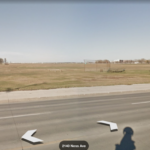
- Former location of No. 8 Repair Depot. Photo: Google Maps.
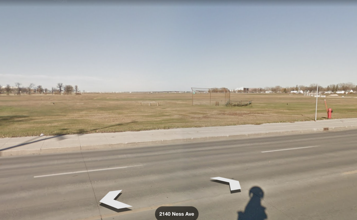
No. 101 Non-Permanent Active Militia Training Centre/No. A-4 Canadian Artillery Training Centre:
Opened at the Brandon Exhibition Grounds, originally as No. 101 Non-Permanent Active Militia Training Centre on 9 October 1940, the camp converted to No. A-4 Canadian Artillery Training Centre on 15 February 1941.
The camp, also known as Fort Brandon Barracks, made use of the existing Provincial Exhibition Display building and the Agriculture Extension building, along with a stately mansion across from the fairgrounds at 1129 Queens Avenue, and additional temporary wartime huts.
After the war, the Exhibition Grounds and its buildings were returned to the City of Brandon. All the above-mentioned buildings remain, as does the motor transport building, located beside the stately mansion on Queens Avenue, but none of the other temporary buildings.
Source Material: The Canadian Army WWII Training Establishments web site – www.canadiansoldiers.com/wwiitrain.htm, “Abandoned Military Installations of Canada Volume 4: Western and Northern” by Paul Ozoark & the personal recollections of the author (2003).
-

- Buildings at the Brandon Exhibition Grounds taken over by the Army during WWII, August 2003. Photo: Bruce Forsyth.

-

- Buildings at the Brandon Exhibition Grounds taken over by the Army during WWII, August 2003. Photo: Bruce Forsyth.

-

- The mansion on Queens Avenue, August 2003. Photo: Bruce Forsyth.

-

- The former motor transport building on Queens Avenue, August 2003. Photo: Bruce Forsyth.

Camp Hughes Transmitter Station:
Opened in 1909 as Camp Sewell, a summer military training camp nine miles west of Carberry.
The camp became a major year round training facility in 1916 for Military District 10, serving as a training camp for numerous cavalry, artillery and infantry regiments including: 1st, 2nd, 3rd, 9th and 10th Canadian Mounted Rifles; 5th Bde. C.F.A.; 37th and 38th Batteries, C.F.A.; 44th, 45th, 46th, 53rd, 61st, and 78th Infantry Battalions.
The camp was re-named Camp Hughes in 1916, in honour of Major General John Hughes, GOC. The camp trained soldiers from the 96th; 100th; 101st; 107th; 108th; 128th; 144th; 152nd; 179th; 181st; 183rd; 184th; 188th; 195th; 196th; 197th; 200th; 203rd; 209th; 210th; 212th; 214th; 217th; 221st; 222nd; 223rd; 226th; 229th; and 232nd Infantry Battalions.
In 1916, the camp underwent further expansion with the construction of all the amenities of a small town: a freight sheds for hay and oats, an ordnance store and office, a Canadian Army Service Corp supply depot; a hospital, administration buildings, an armoury; an engineering office, a railway siding, two churches, a prison, a dental building, a swimming pool, a telephone system, a hospital, two theatres, a barber shop and two banks.
Also in 1916, a trench system was constructed at the camp to teach trench warfare. Camp Hughes trench system, constructed to accommodate a full battalion of 1000 men at a single time, accurately replicated the scale and living arrangements of the trenches in Europe.
In 1917, Camp Hughes reverted to a summer training camp in 1917 after having trained over 30 000 troops. Training was instead re-located to training camps at Shilo and Winnipeg, Many of the soldiers who trained at Camp Hughes later distinguished themselves at the battle of Vimy Ridge, in April 1917
Camp Hughes would continue to be used for training until 1934, when the camp closed. The newly formed Department of National Defence had been looking for other locations for a permanent camp since 1925, due to problems created for training by Camp Hughes proximity to the Douglas Marsh.
As part of a Depression unemployment relief project, the camp’s buildings were dismantled, with some of the buildings being were moved to nearby Camp Shilo,
During WWII, the Camp Hughes site was used occasionally as a training area by soldiers training at Camp Shilo.
In the early 1960s, the site was re-activated as a remote transmitter station for the main communications centre at CFB Shilo. A 2-story underground communications bunker was constructed at the former camp.
Both the Camp Hughes and Camp Shilo bunkers were staffed by the Manitoba Signal Troop, who were later re-designated 731 Communications Squadron. By the end of the cold war in 1991, the bunker’s usefulness had passed. In 1992, the Camp Hughes bunker was closed and sealed up. It was demolished in 2000 and only the roadway leading to it and some fencing remain.
All that remains of Camp Hughes today are the outlines of the old World War I trench system, roadways and numerous building foundations.
The majority of the Camp Hughes area, including those parcels of land currently designated as a provincial heritage site, is leased to local farmers for agricultural purposes.
Camp Hughes is the only remaining Great War military training facility left in the country that still contains a visibly authentic trench and battlefield terrain from that era. Although the abandoned WWI trenches are still visible at CFB Borden, the trench training area at Borden is now heavily forested.
A small cemetery, containing the graves of 6 soldiers who died while training at Camp Hughes, remains owned by the Federal Government and administered by the Commonwealth War Graves Commission.
Source Material: Information supplied by Scott Aikens, Surveyor for the Manitoba Military Historical Society (2000), Town of Carberry web site – http://www.townofcarberry.ca/War.htm, The Military History Society of Manitoba web site – http://www.taniwha.mb.ca/MHSMb/hughes/hughes.html, the personal recollections of the author (2003), Camp Hughes Historical Assessment by William R. Gailbraith, Natural Resources Institute, University of Manitoba (2004), Emergency Government Facilities | DAVE’S COLD WAR CANADA and “Bunkers Bunkers Everywhere” by Paul Ozorak.
-

- Remains of the Camp Hughes training trenches, August 2003. Photo: Bruce Forsyth.

-

- Grave of Private William R. Perkins, CMPC, who died on 26 July 1916, August 2003. Photo: Bruce Forsyth.

-

- Camp Hughes Cemetery, 2013. Photo: JPark99.

-

- Camp Hughes training area, 2013. Photo: JPark99.
-

- Entrance gate to the area where the trench systems are located, 2013. Photo: JPark99.

-

- Aerial view of the swimming pool, July 2016. Photo: Gordon Goldsborough.

-

- Aerial view of trenches remaining from the Camp Hughes training facility, July 2015. Photo: Gordon Goldsborough.

-

- Concrete pad for a former maintenance building, July 2016. Photo: Gordon Goldsborough.

-

- Concrete walls for the former in-ground swimming pool, July 2016. Photo: Gordon Goldsborough.

-

- Sole remaining building at the former Camp Hughes site, July 2016. Photo: Gordon Goldsborough.

-

- Remains of the concrete foundation for one of the buildings at Camp Hughes, July 2016. Photo: Gordon Goldsborough.

-

- Footings for the former train station at Camp Hughes, July 2016. Photo: Gordon Goldsborough.

-

- Photo of the Camp Hughes training trenches during World War I. Historical Photo.

-

- Camp Hughes during World War I. Historical Photo.

-

- Camp Hughes train station. Historical photo.

-

- Bunker and transmitter site, just south of the WWI Camp. Photo: Google Maps.

-

- Camp Hughes Transmitter Bunker under construction, 1962. Photo: DND.
-

- Main gate to Camp Hughes Transmitter Site. DND photo.

-

- Aerial view of the former bunker site. Photo: Google Maps


22 pings
Skip to comment form ↓