


June 2021
We see them as we drive along the roads in Ontario. Some are structures of varying sizes, some are statures or art pieces, some are vehicles or vessels, but all draw our attention in one way or another, like Jumbo the Elephant, found in St. Thomas. Here are just some of the interesting roadside attractions you can find in Ontario:
*********************************************************************************************************************************
Ancaster Tug Boat

At the Owen Sound Marine and Rail Museum.
Famous as one of the two tugs on the reverse of the last Canadian paper dollar bill.
The Ancaster tug boat was built in 1951 in Owen Sound for E.B. Eddy Company of Hull, Quebec, a Canadian pulp and paper company. It sank in 1979 at the foot of Chaudiere Falls on the Ottawa River, but it was raised and restored in 1982 by new owners Ottawa Hydro, who used the tug until 1991. It was then sold to Owen Sound Marine & Rail Museum and returned to its original home port. It’s now on display outside the museum.
The Ancaster’s claim to fame is for appearing on the backside of the final version of the Canadian one-dollar bill.
*********************************************************************************************************************************
Arctic-Atlantic Watershed Marker


These roadside markers can be found on Highway 17, north-west of Thunder Bay, near the tiny village of Raith, Ontario. The back-to-back signs, one facing north, the other facing south, denote that all rivers and streams from this point flow to either the Arctic Ocean or the Atlantic Ocean respectively.
Similar signs can also be found on Highway 11 near Kenogami, Highway 144 near Gogama, south of Chapleau on Highway 129 and on Highway 11 near Geraldton.
*********************************************************************************************************************************
Barrie Spiritcatcher

Also called the Dream Catcher, this 20 ton, 70 foot wide by 65 foot tall sculpture sits on the north shore of Kempenfelt Bay in Barrie, Ontario. Originally created by sculptor Ron Baird for Expo 86 in Vancouver, B.C., it was donated to the City of Barrie and officially dedicated on 12 September 1987.
The Spirit Catcher has become such an iconic structure in Barrie, that it is frequently used in visual displays depicting the city. It has also inspired the creation and installation of other public pieces of art around the city.
*********************************************************************************************************************************
Beardmore Snowman

Although it’s actually built of white wood, this 35-Foot-Tall Snowman with an information kiosk in his corpulent belly, claims to be the world’s largest snowman.
With his hat, fishing rod and sunglasses, replaced in the winter with a scarf and curling broom, he is easily spotted by visitors travelling along Highway 17 in Beardmore, Ontario.
*********************************************************************************************************************************
Coppermine Point Lighthouse

Coppermine Point Lighthouse is one of the many lighthouses along the shores of Lake Superior to have guided thousands and thousands of ships along their journey.
Although no longer at its original location, this particular lighthouse was build in 1908, replacing previous lighthouses that stood at Coppermine Point. Constructed out of wood, in a square shape with sloping sides and surmounted by an octagonal iron lantern, is 32 feet high.
Coppermine Point on the Ontario side and Whitefish Point in the United States define the entrance to Whitefish Bay, the southeastern extreme of Lake Superior. It was at Whitefish Point where the doomed lake freighter S.S. Edmund Fitzgerald, was hoping to seek refuge from a violent November storm when it sank on 10 November 1975, with the loss of the entire crew of twenty-nine. The wreck lies approximately thirteen miles west of Coppermine Point and fifteen miles north of Whitefish Point.
The lighthouse was moved around two miles north along highway 17 to Hibbard Bay, where it became part of a non-demolished restaurant complex.
*********************************************************************************************************************************
Goderich Lighthouse

The 35-feet tall Goderich Lighthouse actually pre-dates Canada itself, having become operational in July 1846. Perched atop a 140-foot high bluff overlooking the Goderich water front, it was built by Scottish immigrant Adam MacVicar, a stone mason who also worked on the construction of the Welland Canal.
The lighthouse, which is no longer active, and the surrounding land was sold to the Town of Goderich in 2009. It was restored to its original condition and is now the centrepiece of Lighthouse Park.
*********************************************************************************************************************************
Horseshoe Resort giant Muskoka chair

Situated out front of the Horseshoe Resort, a year-round ski and golf resort in Oro-Medonte Township, north of Toronto, it’s one of many giant Muskoka chairs (also known as an Adirondack Chair) that can be found in Ontario.
*********************************************************************************************************************************
Innisfil’s giant rocking horse

The Town of Innisfil, Ontario, north of Toronto, is home to a rocking horse that once held the Guiness Book of World records title for the largest rocking horse in the world. That record now belongs to a rocking horse built in Linyi, Shandong, in 2014.
The 5,500-pound ponderosa pine rocking horse, which is 23-foot-long by 20-foot high and nine-foot in width, was built by Munro’s Furnishings in 2010 and sat outside their facility at Highway 400 and Innisfil Beach Road.
When Munro’s Furnishings sold their property in 2015, the rocking horse was temporarily moved to the InnPower yard on Yonge Street in Innisfil. The following year, it was moved to its current home at the Spring Tree Farm on Innisfil Beach Road.
*********************************************************************************************************************************
Radar monuments dedicated to the former Pinetree Line in Kapuskasing and Clinton
In the early 1950s, the Pinetree Line network of radar stations was established. This line, which featured a total of 44 stations, stretched along the 50th parallel, down the eastern coast and into southern Ontario and Quebec, and acted as an early warning detection system against a Soviet air attack.
The Pinetree Line was shut down over several years, starting in the mid-1980s, as part of the North American Air Defence Modernization Plan, with the final stations closing in 1991.

This AN/FPS-26 Height Finder radar antenna was donated to the Town of Kapuskasing after the closure of nearby RCAF Station Lowther in 1987. It stands along Highway 17, beside the Kapuskasing Via Rail Station and the Ron Morel Memorial Museum.

Although RCAF Station Clinton was not a Pinetree Line station, it was the home of radar training from 1941, when the home to the No. 31 Radio Direction Finding School, under the British Commonwealth Air Training Plan, until the base closed in 1971.
This radar antenna, which was used by students at the training school, is located in a small parkette on Highway 4 (Victoria Street), south of Highway 8 (Ontario Street), in downtown Clinton.
*********************************************************************************************************************************
Kapuskasing’s Passage Through Time

The Passage Through Time sculpture in Kapuskasing pays tribute to the town’s pulp and paper mill history. The sculpture depicts lumber’s transformation from log to newspaper.
The sculpture stands along Highway 17, beside the Kapuskasing Via Rail Station and the Ron Morel Memorial Museum.
*********************************************************************************************************************************
Puslinch PPC Streetcar

This is a bit of an accidental roadside attraction. Located beside Highway 6 in Puslinch Township, Ontario, this old PPC streetcar, once used by the Toronto Transit Commission (TTC), sits in a field of a cattle farm called Wagyu World. Stripped of its motorized parts, it still retains the TTC’s distinct cream and red livery colours. As it has been in this state for years, rusting more and more each year, it seems the owner doesn’t have any specific plans for the aging streetcar.
Be forewarned that this streetcar is on private property and the owner hasn’t been known to be friendly to those wishing to take photos or have a closer look inside the streetcar. Any photos should be taken from the road.
*********************************************************************************************************************************
Railroad Jigger & Model of the YMCA
Schreiber, Ontario

The Town of Schreiber, Ontario, began as a construction camp named Isbester’s Landing in 1883, for workers building the Canadian Pacific Railway across Canada. The town was later re-named after Sir Collingwood Schreiber, a railway engineer who would later serve as the deputy minister of Railways and Canals from 1892 – 1905.
Over the years, housing was built for CP Railway employees in the town, but the local YMCA also provided accommodations.
Today, Schreier is still a very active railway centre for CP Railway. Some of the old railway homes remain, but the YMCA building that housed the workers no longer stands. Near the rail yards, close to where the Schreiber Railway Museum was once located, one will find a miniature scale model of the old YMCA building, along with a self-propelled railway jigger, a small railway vehicle normally used by railway service workers. The museum relocated to a modern facility along Highway 17 in the west end of town in 2019.
Due to its northern Ontario location, during World War II, Schreiber was the site of one of the four work camps housing Japanese-Canadian internees, along with prisoner of war camps from Europe and the Pacific theatre.

*********************************************************************************************************************************
Star Carwash Firebird on a Pole

What better way to advertise for an automotive related business, in this case a car wash, is a car on a pole. In Elmvale, Ontario, a Pontiac Firebird sits on a large metal pole out front of Star Carwash on Queen Street West.
*********************************************************************************************************************************
McNally excavator in Hamilton

Out front of the McNally International, Inc. head office on Barton Street East in Hamilton, Ontario, sits an old cable-operated Northwest excavator, once a valued workhorse for the construction and tunnelling company.
When the era of the steam shovels came to an end, it was the cable-operated models of excavators that became a necessary tool on many construction sites, and one of the more popular models used by construction companies were the excavators manufactured by the Northwest Engineering Company of Green Bay, Wisconsin.
Beginning in 1921, Northwest was just one of the companies in the 1920s that introduced diesel and gasoline-powered universal excavators to the construction world. While they are considered overdesigned by today’s standards, Northwest’s excavators quickly gained a reputation of being tough machines that could handle any job other than going through solid rock.
Like the steam-powered shovels they replaced, the cable-operated excavators were themselves replaced by hydraulic excavators.


********************************************************************************************************************************
Sandwich Windmill

The Sandwich Windmill is a replica of one of the many wind-powered grist mills that lined the south shore of the Detroit River, between the villages of Sandwich and Tecumseh, during the 18th and 19th centuries.
This replica was built in 1992, in Mill Park, at the foot of Mill Street.
*********************************************************************************************************************************
Terrace Bay Lighthouse

In downtown Terrace Bay, sits a 50 foot tall replica of the lighthouse that used to sit on Slate Islands, just off shore from Terrace Bay.
Built in 2011 as a nod to the town’s connection to the Slate Islands, it features an observation platform at the top, that allows visitors a spectacular view of Lake Superior.
*********************************************************************************************************************************
Top End Restaurant Mini-Train

Although this one has since been removed, I was particularly fond of this one because of my love of trains, This stationary mini-train once sat at the roadside along David Winkler Parkway in the Village of Neustadt, near the intersection of Queen Street. It served to advertise the now-closed Top End Restaurant & Tavern in Neustadt, a popular eatery located right beside the former Canadian National Railway line that once ran through the village in Grey County.
*********************************************************************************************************************************
Trail of the Caribou

The Trail of the Caribou was an airplane that made the first successful overseas flight from Canada. On 8 August 1934, the Trail of the Caribou, piloted by Canadians James Ayling and Leonard Reid, took off from the small cottage town of Wasaga Beach, Ontario.
Using Wasaga’s naturally long and straight beach as a runway, Ayling and Reid began what would be a 30 hours 55 minutes flight across the Atlantic Ocean to Heston, Middlesex, England.
This scale model of the Trail of the Caribou commemorates the historic flight.
The original airplane, built by deHavilland Aircraft of Canada, was a “Dragon” Moth D.H. 84 – a fabric-covered, 34-foot, six-inch long, twin-engine biplane with a 47-foot, four-inch wingspan.
*********************************************************************************************************************************
Ganonoque Leaping Muskie Fish Statue

At the entrance to town you can’t miss the huge concrete statue of the “1000 Islands Muskie.” Gananoque is where the world’s record muskie — over 69 lbs — was caught by H.A. “Dooley” McCarney in an area know as 40 Acre Shoals.
Found at the eastern edge of Ganonoque, this statue of the “1000 Islands Muskie” is in tribute to the record-setting 69lbs muskie that was caught by H.A. “Dooley” McCarney in an area known as 40-Acres Shoals, near Ganonoque.
*********************************************************************************************************************************
Other Interesting Roadside Attractions


**********************************************************************************************************************************
Other roadside attractions that I’ve profiled in previous articles:
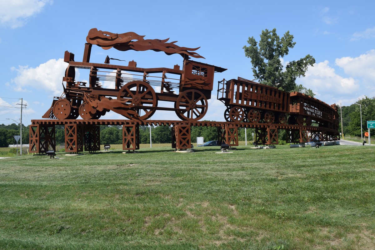
Jumbo the Elephant – The “pride” of St. Thomas – Canadian Military History (militarybruce.com)
Roadside attractions – The Varney Big Chair – Canadian Military History (militarybruce.com)
Muddy the Mudcat – The pride of Dunnville – Canadian Military History (militarybruce.com)
The Big Apple – A unique roadside attraction – Canadian Military History (militarybruce.com)
A schoolhouse on rails – Canadian Military History (militarybruce.com)
Abandoned ship now a local landmark – Canadian Military History (militarybruce.com)
Borden Legacy Monument officially dedicated – Canadian Military History (militarybruce.com)
Lest We Forget – Woodbridge War Memorial Tower – Canadian Military History (militarybruce.com)
The Listowel Clock Tower – Canadian Military History (militarybruce.com)
The strange saga of Scary Lucy – Canadian Military History (militarybruce.com)
The Wawa Goose – A uniquely Canadian statue – Canadian Military History (militarybruce.com)
White River – The home of the real Winnie The Pooh – Canadian Military History (militarybruce.com)
Who has the smallest jail in North America? – Canadian Military History (militarybruce.com)
**********************************************************************************************************************************
Sources: Green Motion | Roadside attractions in Ontario, Canada, Roadside Attractions, Terrace Bay Lighthouse | Township of Terrace Bay, Coppermine Point Lighthouse, Ontario Canada at Lighthousefriends.com, The Gales of November: remembering the Edmund Fitzgerald (ontarioparks.com), Innisfil’s giant rocking horse finds a new home (simcoe.com), Days Out Ontario | Rocking Horse, Roadside Attractions, https://www.roadsideamerica.com/tip/8293, https://lakesuperiorcircletour.info/location/beardmore-snowman, https://en.wikipedia.org/wiki/Greenstone,_Ontario, Ancaster | Great Lakes Tugs & Workboats (wordpress.com), Height of Land Signs | Northern Ontario Travel, Spirit Catcher – Wikipedia, Coppermine Point Lighthouse, Ontario Canada at Lighthousefriends.com, A Kapuskasing Weekend Guide | Northern Ontario Travel, photoblair.ca: Highway 6 Rocket, Rails Across Ontario: Exploring Ontario’s Railway Heritage by Ron Brown, Features (toytrucker.com), Trail Of The Caribou (wasagabeachpark.com), https://www.simcoe.com/news-story/2004179-trail-of-the-caribou-flies-again.
.

